Reading front symbols on weather charts
Front symbol carries 3 things: front type, advancing air mass, direction of movement.
Surface weather map (TC AIM MET 10.0 item 5; shapes from Figure 10.1 legend):
| Front | Colour | Symbol | Meaning |
|---|---|---|---|
| Cold | Solid blue | Triangles (pips) | Cold air advancing |
| Warm | Solid red | Semicircles (half-moons) | Warm air advancing |
| Stationary | Alternating red and blue | Segments | Neither air mass advancing |
| Occluded | Purple | Single line | Faster cold front overtook warm front |
- Trowal: hook marks in red and blue (TC AIM MET 10.0). TROWAL defined in MET forecast-contraction glossary.
Line style and colour (TC AIM MET 10.0). Applies to any coloured line above:
- Solid: air-mass change reaches ground and aloft.
- Dashed: "upper air" front only. Change aloft, not at surface.
- No colour: black-and-white symbols carry same information.
Symbols point in direction front is moving (AWH 25.2.2.1.3).
Significant weather prognostic chart (mid/high level), legend TC AIM MET 12.1(c):
- Separate symbols: warm front, cold front, occlusion, quasi-stationary front, trough of warm air aloft, upper trough, trough line.
- Quasi-stationary front = surface chart's stationary front.
- Also shown: mean sea level isobars (millibars), 0 degree Celsius isotherm height (hundreds of feet).
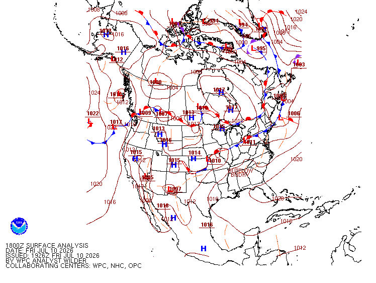
Trap: triangle vs half-moon mix-up: sharp triangle = aggressive cold front shoving in, rounded semicircle = gentler warm front sliding up and over.
References
- TC AIM MET 10.0
- TC AIM MET 12.1(c)
- AWH 25.2.2.1.3